Recent articles
© DT Online 2010 - 2026
| Brookfield Garth Proposed DevelopmentHAMPSTHWAITE ONCE AGAIN UNDER THREAT!PROPOSED RESIDENTIAL DEVELOPMENT BROOKFIELD GARTH, HAMPSTHWAITE Proposed Brookfield Garth Layout
Stonebridge Homes are currently applying to Harrogate Borough Council to build 46 houses on the field which Brookfield Garth leads into - i.e. almost as many again as are being built at Grange Park. Hampsthwaite Parish Council have submitted objections to this proposal. The purpose of this Newsletter is to bring this matter to your attention and to help those who wish to join in objecting to submit a response this coming weekend - in writing via a collection box placed in the Post Office or by email to the Case Officer : Andrew.Siddall@harrogate.gov.uk It is understandable, following HBC’s approval of Grange Park, that some will think it unlikely we can halt these developments but it is precisely because of Grange Park that previous arguments are now stronger still - so please do not hesitate to make them again - even HBC must eventually learn to listen! NOTE: You must include the reference 17/01597/OUTMAJ and your name and address in any form of communication. Full details of the application plus how to submit comments online can be viewed on the HBC website at https://uniformonline.harrogate.gov.uk/online-applications/ - Just enter Brookfield Garth in the Search Box click on Documents and then View Associated Documents (Note: site details are on Page 2).
To comment online you will need first to click on Register and enter just a few details. View also our previous responses to such proposals at http://www.hampsthwaite.org.uk/parishcouncil/582 Issues for consideration and challenge:
Traffic:  The Transport Statement (on Page 2 of Associated Documents) states that "the development is just 46 units, that a Transport Statement (TS) is appropriate to accompany the planning application rather than a full Transport Assessment . . . . a ‘lighter-touch’ evaluation . . . with anticipated limited transport impacts . . . with just 25 two-way trips generated in both the morning and evening peak hour periods . . . transport impacts of the development will be minimal"
This ignores completely the current development 56 dwellings at Grange Park and grossly underestimates the additional volume of traffic that the addition of 46 homes, including some with 5 bedrooms, will generate. Many existing households, particularly where there are 17 – 25 year olds, have 3 or 4 cars, as they need to be able to access school, jobs and leisure activities in Harrogate and beyond as there is nothing for them in the village. Almost all traffic generated by both Brookfield Garth and Grange Park will of necessity egress and return via the Brookfield / Hollins Lane junction and turn right towards Harrogate, Leeds or York - because this is where the employment, schools, retail and leisure centres are located. This junction is known to be sub-standard with poor visibility - especially for right turners. Given the nature and price range of the 100+ dwellings at both Brookfield Garth and Grange Park combined it is not unreasonable to suppose that the volume of traffic at this junction is likely to be an extra 100 or even 200 journeys per day rather than the 25 stated in the Transport Statement. The traffic turning left at the junction, or going down Dale Close, towards the village centre, will add to the existing congestion of the High Street. There is no public car park in Hampsthwaite and only limited street parking. The detrimental impact of extra traffic on our village centre and surrounding roads was highlighted in the 1984 Appeal Judgement against Tay Homes (p5 para 22) and upheld by HBC against Victor Homes in 1990 (ref: Rule 6 Statement). The problem of congestion is now considerably increased as a result of the Grange Park development and the approval of a total of 17 homes at Cruet Fold in recent years. Housing Density:
The land identified for the Brookfield Garth development was confusingly (and incorrectly) indicated in the October 2010 LDF as being Site Option RL2061 with an area of 0.5ha and capacity for 16 dwellings. The current proposal now variously measures this site as 1.21ha (Planning Case Report/Statement para 2.5), 1.24ha (Design and Access Statement para 2) and 1.34ha (Planning application form Q21 and Drainage Strategy Report para 1.2). Such errors and variations cast doubt upon the accuracy of any of the calculations in the proposal and the rigour with which the application has been made. In addition, the Drainage Strategy Report (para 6.2) refers to “32 Brookfield” – there is no such address! Assuming 1.34ha to be the actual area of the site, 46 dwellings would generate a density of 34.3 dwellings per hectare. HBC's 4.1 Draft Policy HS1: Type, Mix and Density of New Housing states: "Higher densities of between 30 and 50dph will be sought on appropriate sites within the main built up areas of Harrogate, Knaresborough and Ripon." There are no grounds on which Hampsthwaite can be considered a 'main built up area' and this serves to underline the danger of this proposal making it so. The Tay Homes Appeal Judgement Aug 1984 (upheld by HBC in 1990) alludes to this by stating that such developments ". . . would be detrimental to the character and appearance of the area and general environment of Hampsthwaite". This danger is now exaggerated by the current building of 56 homes at Grange Park. The high density of housing proposed is achieved by providing inadequate narrow access roads and insufficient off-street parking. It is inevitable that an excess of on-street parking will result causing access issues for utilities and emergency vehicles. The poor access manifests itself also in the lack of rear access for some of the dwellings. The crowding together of dwellings makes it ". . . unclear from the Site Layout drawing how the residents of Plots 2, 7, 10, 15, 29 & 32 will access their rear gardens, other than through the property, which contravenes the recommendations contained in section 12 of BFL12 which indicates that the design should allow residents the opportunity to access their garden without having to walk through their home" (ref. Police Architectural Liaison consultation report). Drainage:
The Flood Risk Assessment makes no reference to inundation from underground springs but it is known locally that these exist - and have caused issues at the adjacent Grange Park development. There is no mention of the beck/drain on the northern boundary and the fact that it floods 15 Brookfield. Even with these omissions, the report acknowledges that "The risk of flooding from water falling on site and not being able to leave the site is relatively high" The report rather contemptuously declares that "any flood waters leaving this system would be channelled along the highways by the natural topography away to the north, and would not enter the site" - maybe not but the photo shows what happens 'to the north' afterwards! In an attempt to mitigate any on-site flooding problems the report suggests "The floor levels of the proposed houses should be a minimum of 300mm above the existing ground level" thus increasing their detrimental visual impact on neighbouring properties. Brookfield itself has been subjected to serious flooding in recent years and Hollins Lane continues to be overwhelmed at times of even moderate rain - to the point where manhole covers lift causing a danger to traffic and gardens at the bottom of Hollins Close have been inundated. In summary, surface water drainage issues appear not to have been given due consideration and may not be taking the current development of 56 houses at Grange Park fully into account (i.e. an over-emphasis on solutions towards the NW corner although this space is occupied, and problems added to, by Grange Park). In response to Q12 on the Planning application form it is stated that there will be no increase risk of flood risk elsewhere but this is contradicted in para 5.3.1 on Flood Risk Assessment. Also, in response to the same question, the application states that surface water is to be dispersed into sustainable drainage system and not existing watercourses but this is contradicted by para 6.1 in the Drainage Strategy Report. Education:
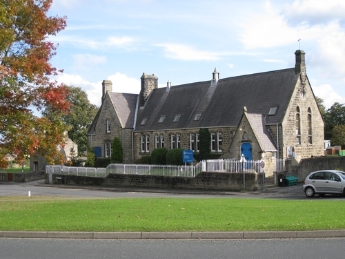
The reports from the County Education Officer confirm that the school is already over-subscribed, even without the new families predicted for The Grange development. The school was extended 6 years ago with a resulting loss of play area, there is not sufficient room to extend further within its present boundary prompting much concern that any future development might compomise Feast Field. The Parish Council lease the sports and recreation field (Feast Field), from NYCC for the use of the whole village. This is the only publicly accessible general recreation space in the village. Loss of this would be wholly detrimental to the health and well-being of all and would contravene the requirement for such spaces in the National Planning Policy Framework which states: "Existing open space, sports and recreational buildings and land, including playing fields, should not be built on . . . unless replaced by equivalent or better provision in terms of quantity and quality in a suitable location". There is no other land available within the village boundary to create a replacement. The figure of only 11.5 additional school places being being generated by the proposed 46 properties of up to 5 bedrooms each, seems grossly underestimated and the current over-subscription is evidence that such estimates have proved to be so in the past. Infrastructure:
The Tay Homes Appeal Judgement Aug 1984 (upheld by HBC in 1990) refers to the "rising and more prominent land to the south . . . [and in 1984] . . the population had nearly doubled since 1961". Since then there has been little change to infrastructure and services have diminished. Hampsthwaite has over the past few years absorbed additional housing including The Grange, an adjacent major development of 56 houses currently under construction which, given the size of houses being built, is likely to increase our existing population by 15.5% to 26%. The building of a further 46 homes, also up to 5 bedrooms, will potentially increase the size of the village again by a similar amount meaning that population will have increased by almost another 50%. !t is even more apparent now therefore that the Appeal Judgement of 1984 holds true - i.e. "the possible addition of not only 150 - 200 people, but also the additional vehicular traffic generated by this increase, would impose a social and physical strain on the village and would have a seriously adverse effect on the environment in the centre of Hampsthwaite and on the surrounding roads". There is simply no local need for further housing for decades - of the 450 houses already in the village there are almost always five to ten for sale. Hampsthwaite does not and should not need to provide an infrastructure to cope with a development of the size envisaged. Land and foul drainage, bus and local services are insufficient to adapt to an urban sprawl. In Hampsthwaite there is one shop, a post office, a pub and doctor who already has the quota of patients for the area. Environment:
The proposed development would take away open countryside, including a Public Footpath linking Rowden Lane with Hollins Lane. A hard surface path through a housing estate will not have the same amenity value as the existing path. We judge the report from the NYCC Footpaths Officers to be somewhat perfunctory but we understand the difficulties imposed by current staffing and budget cuts. By contrast, the Ramblers' Association rightly express concern that: "at the extreme east end of the path, between plots 13 and 14, the path is to be covered in tarmac and would often be obstructed by vehicles". Brookfield Garth Proposed Development HAMPSTHWAITE ONCE AGAIN UNDER THREAT!PROPOSED RESIDENTIAL DEVELOPMENT BROOKFIELD GARTH, HAMPSTHWAITE Proposed Brookfield Garth Layout
|


