Recent articles
© DT Online 2010 - 2026
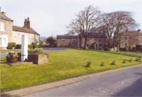
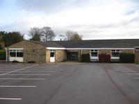
| Information about HampsthwaiteHampsthwaite is a North Yorkshire village 5 miles north west of Harrogate and lying to the south of the river Nidd. Hampsthwaite Memorial Hall Bookings are now available via an online system by Hallmaster. This helps us maintain an online calendar of availability at http://www.hampsthwaite.org.uk/memorialhall/524.. See Notices and Events for details of Hampsthwaite events and activities See Hampsthwaite Housing 2025 for details of 'Call for sites' 3 ways to help make this happen:
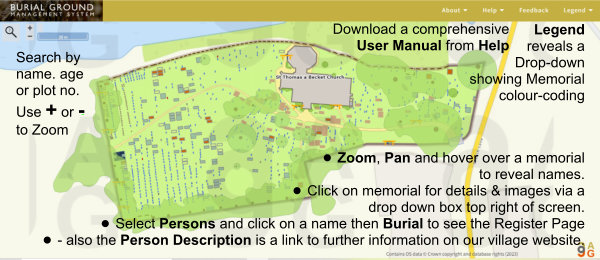
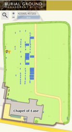
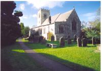
1.https://www.easyfundraising.org.uk/causes/hampsthwaite-memorial-hall/ Easy Fundraising - this is FREE : it will cost you nothing. 2.https://www.thelocallotto.co.uk/support/hampsthwaite-memorial-hall Local Lotto - £1 per ticket but you could win £25,000 3.Acc.Name: Hampsthwaite Memorial Hall SortCode: 53-50-21 Acc.No.: 00312932 BACS transfer - or just make a donation directly via BACS Very many thanks for any help you feel able to provide. Without good public support this simply cannot happen at all. Support Our Local LottoWin up to £25,000 - Tickets cost just £1 a week - Help us continue to improve the Hall and maintain the car park! Click on the image or HERE to PLAY NOW Recycle4Charity is a free, easy to use programme for empty ink cartridges. A simple way to help the environment whilst raising money for the charity of your choice - click on logo for details. Donations of up to £2 for each eligible ink cartridge will be paid to our Memorial Hall - simply leave them in the box in the Foyer or post through the letter box. Memorial Hall Community Shed / Arts & Crafts StudioWe did it! We have full planning permission and have just been awarded the grant we applied to FCC for! A big, big THANK YOU to everyone who bought a Lotto Ticket, ticked a survey box, wrote letters of support, and especially those who pledged donations. Without each of those actions this would quite siimply not have been achieved. Now the work begins! We need to build it, furnish it, fit it out and equip it! Click on the image for full details of the projectMapping Hampsthwaite's PastResidents may have seen others wandering around our churchyard with cameras, clipboards and, occasionally, even scrubbing brushes! Some have also been kind enough to compliment the PayBack Team on all the good work they are doing there to keep the grass trimmed so we can read the various inscriptions - some of which reveal both heart-rending stories and, in contrast, some very interesting uses of our English language!This activity has made possible our completing the St Thomas a’Becket Burial Ground Project to the point where the work thus far can now be made public and viewed. COFFEE CLICK & CONNECT
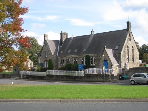
Change of Times: STARTING AUGUST 3rdThe Mobile Post Office service for Hampsthwaite will now call at the Memorial Hall each Thursday afternoon between 13.50hrs and 15.05hrsVisit our History section for more information on Hampsthwaite past. An Interactive Map of Hampsthwaite is available which provides links to database entries on many locations in the village. Hampsthwaite CE Primary School is at the heart of the village and the focus for many community activities. Nidderdale Greenway Extension There has been an ambition for at least 25 years to have a path – the Nidderdale Greenway Extension - from Harrogate through Nidderdale to Pateley Bridge and as far as Scar House Reservoir. The current Greenway opened in 2014 from Harrogate to Ripley and is very popular with walkers, cyclists, wheelchair users and horse riders of all ages and abilities. [Note: Of immediate concern is that the Horseshoe Path which connects the Greenway to the bottom of Clint Bank has become virtually impassable. The local action group, Hampsthwaite Pathfinders, has made some progress to seek a solution - more of this to follow.
Link to Hampsthwaite in Wikipedia, the free encyclopedia. The entry includes a comprehensive listing of other sites relating to Hampsthwaite obtained by clicking on the Map sources for Hampsthwaite link at the bottom of the page. Heritage Gateway This website allows you to cross-search over 60 resources, offering local and national information relating to England’s heritage. Just enter Hampsthwaite into the Search Box to uncover a listing of the records available which relate to Hampsthwaite's local heritage. Yorkshire Industrial Heritage Online Recording and Communicating Yorkshire's Industrial Heritage - this searchable database of Yorkshire's industrial heritage includes some references to places and people in Hampsthwaite. The aim of YIHO is to provide free web access to information about Industrial Heritage Sites within the historic county of Yorkshire. YIHO is a fully searchable database, that has been developed by a group of Industrial History Societies, and which aims to provide an on-line repository for members' knowledge, photographs research notes, audio, and sound recording of industrial sites, artefacts and processes. The National Library of Scotland has an online 'Map images' resource you can access and view all the maps they have scanned as high-resolution, colour, zoomable images. The maps date between 1560 and 1964 and although relate primarily to Scotland they also have maps of areas beyond Scotland, including old maps of Hampsthwaite.
The easiest way of finding material relating to any particular location is to use the Find by Place search tool. Note also that there is also a Side by Side tool which enables you to view an old map alongside a modern view to compare them. Link to Streetmap.co.uk to see street maps of the village and surrounding area. Link to Google Maps to see street maps, get directions on how to get here and search for local businesses. Link to Flood maps enter your Post Code to see where the Environment Agency estimates there may be floodplains if the river rises above its banks. Link to CalverleyInfo is dedicated to the collection and free publication of all historical and genealogical information pertaining to Calverley Parish and the surrounding district and villages - including Hampsthwaite. The original Hampsthwaite village web site remains as an archive and may still be accessed by clicking here Information about Hampsthwaite Hampsthwaite is a North Yorkshire village 5 miles north west of Harrogate and lying to the south of the river Nidd. Hampsthwaite Memorial Hall Bookings are now available via an online system by Hallmaster. This helps us maintain an online calendar of availability at http://www.hampsthwaite.org.uk/memorialhall/524.. See Notices and Events for details of Hampsthwaite events and activities See Hampsthwaite Housing 2025 for details of 'Call for sites' |


